Authors:
Historic Era: Era 2: Colonization and Settlement (1585-1763)
Historic Theme:
Subject:
September 2022 | Volume 67, Issue 4
Authors:
Historic Era: Era 2: Colonization and Settlement (1585-1763)
Historic Theme:
Subject:
September 2022 | Volume 67, Issue 4

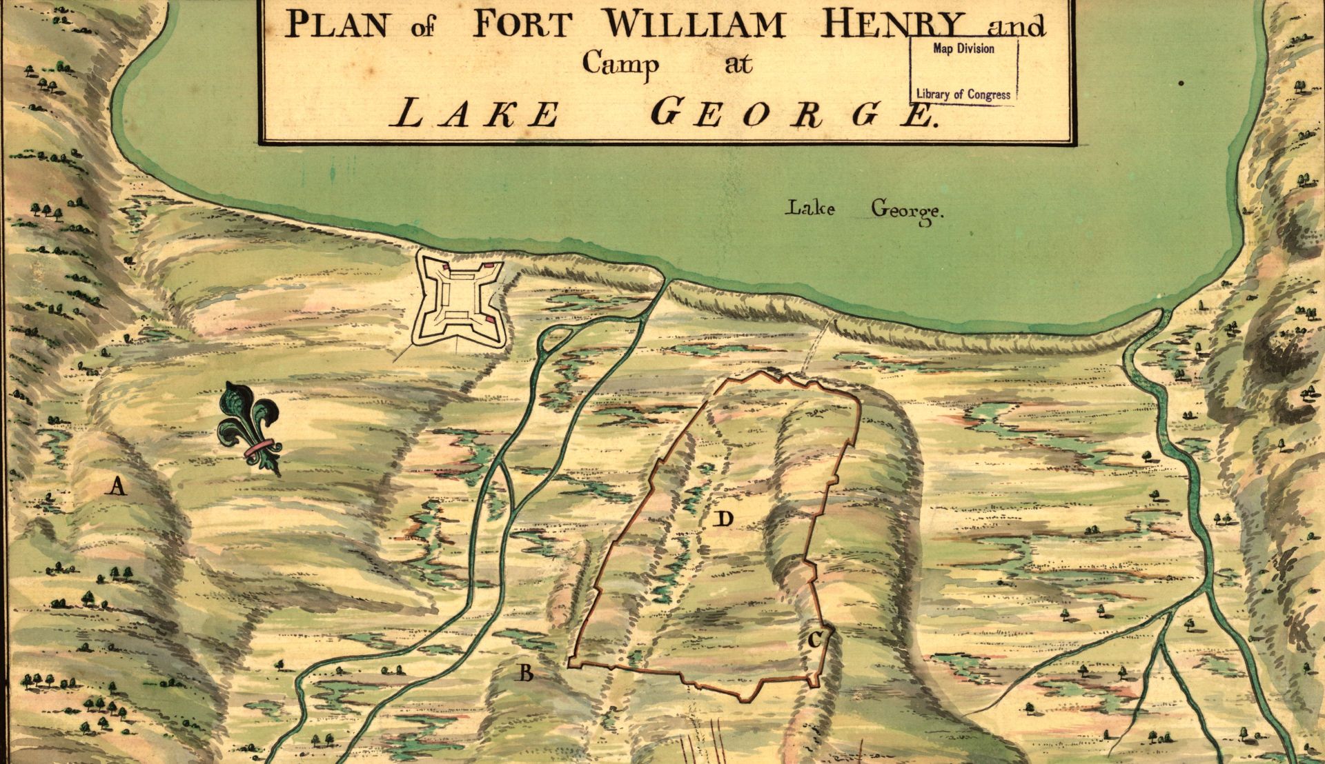
By artfully illustrating the boundaries of colonial powers, mapmakers in the 1700s helped define what our New World would become.
September 2022 | Volume 67, Issue 4
Editor’s Note: Neal Asbury is an entrepreneur, map collector, and host of a nationally syndicated radio talk show. Jean-Pierre Isbouts is a professor of history and an award-winning screenwriter and film director. They are the authors of Mapping America: The Incredible Story and Stunning Hand-Colored Maps and Engravings that Created the United States, in which portions of this essay appeared.
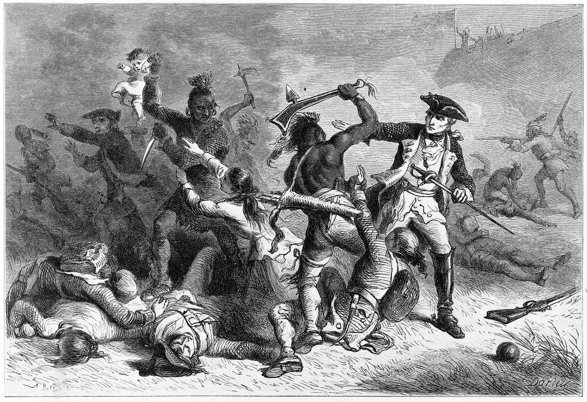
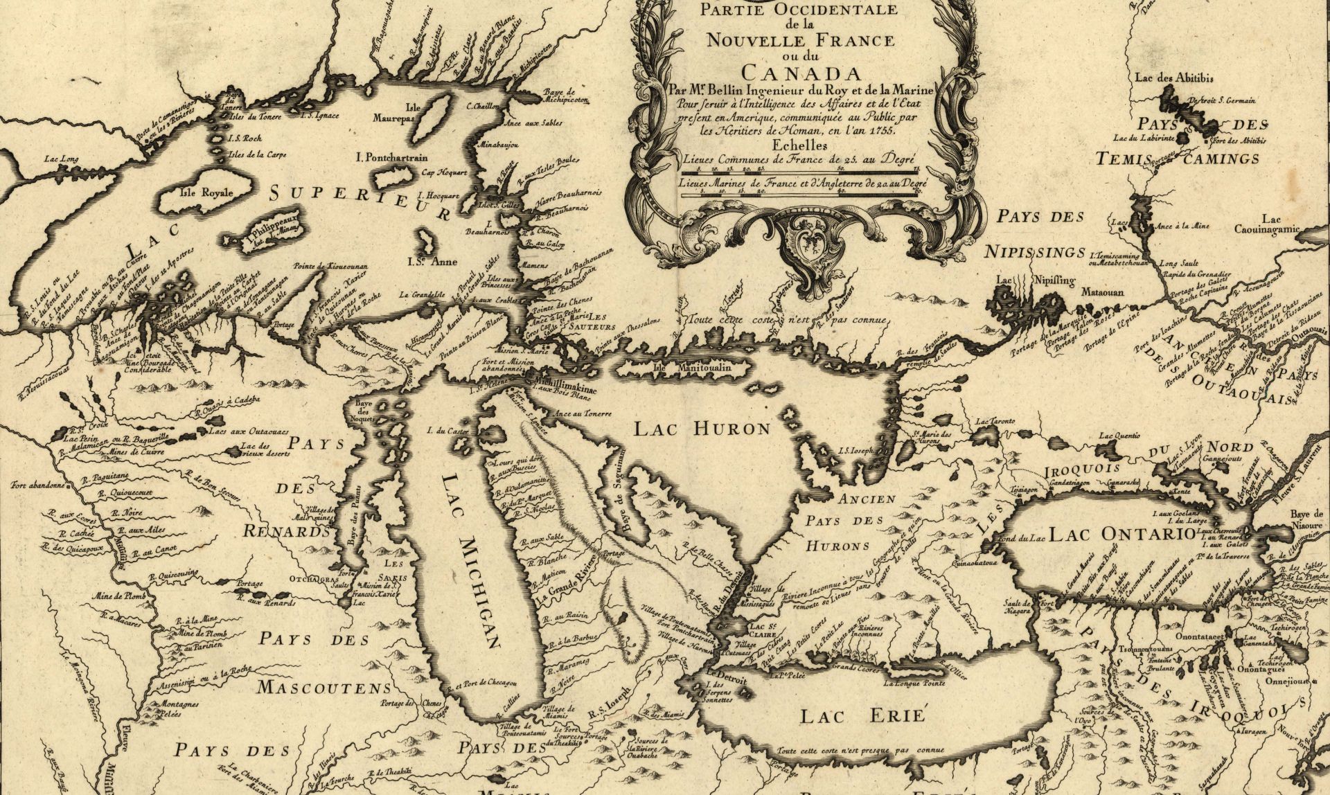
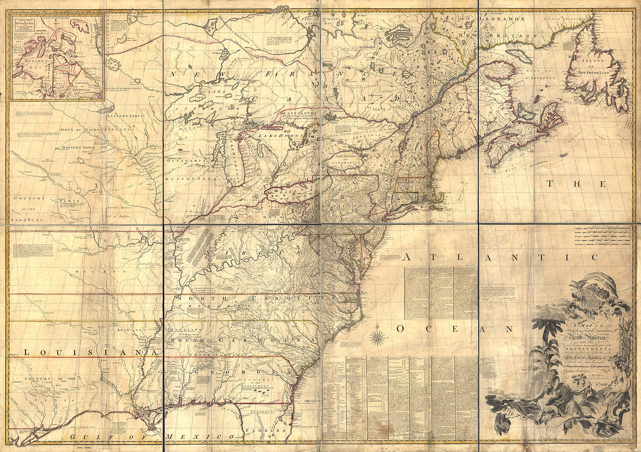
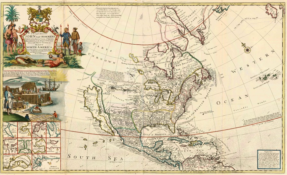
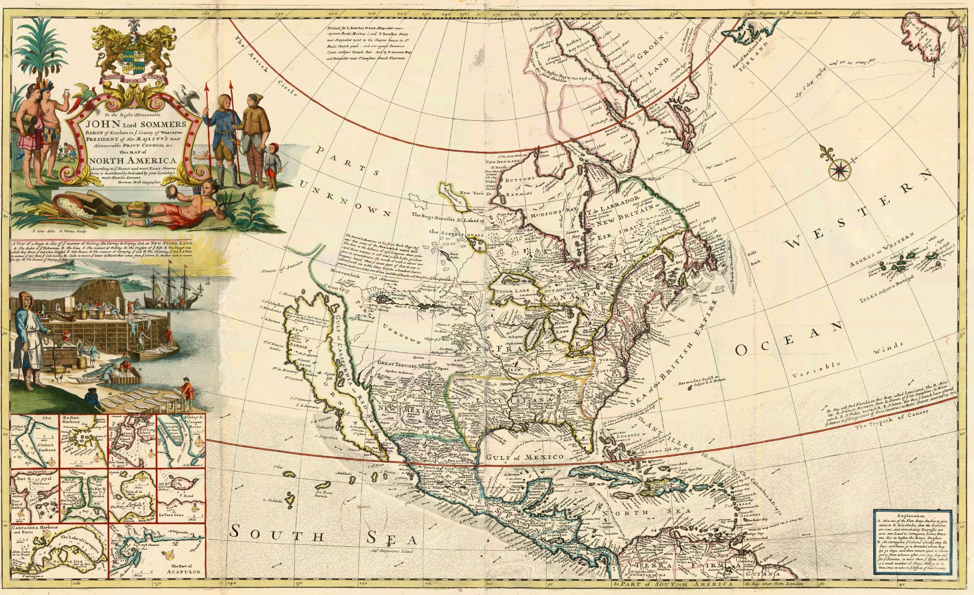
During the 18th century, mapmakers, surveyors, and cartographers of the English colonies in America took on a new role. Up to this point, creating maps of the American continent had been an art as much as a science, designed to appeal to a broad public on both sides of the Atlantic Ocean. For European buyers, especially, a map of America was a glimpse of a faraway and exotic land, populated by Indians and fearsome animals amid a wild and exuberant landscape that had yet to be tamed by human hands.
But this changed as the conditions on the ground shifted, and life for the colonists became more perilous. The reason is that, for much of the 17th century, the American colonies had been shielded from the great conflicts that scourged Europe. True, there were clashes between French, Dutch, English, and Spanish colonists, but most of these contests had to do with local boundaries or trade, rather than the big political matters that vexed the European powers some three thousand miles away. But, as the American colonies matured into a powerful entity in their own right, they were bound to be sucked into a string of conflicts that roiled Europe throughout this period.
In 1743, King George II of Britain decided to see what spoils he could get for himself. Before long, the English and French armies met at the cataclysmic Battle of Dettingen, which ended in a heavy defeat for the French. Of course, this called for revenge, and so the French generals came up with a rather daring gambit: to invade Great Britain and restore a Catholic king to the throne. But on the night the French fleet was about to sail, a violent storm lashed the ships’ berths, ripped their sails, and toppled their masts, so the invasion attempt was abandoned. Thus repulsed at sea, the French continued to fight on land, one battle after another, while vast sums were spent and not much of anything was accomplished.
The news that France and Great Britain were locked in a fierce European war soon reached American shores. Here, it once again inflamed the