Historical Era:
Place Created: Paris, France
Year Created: 1700
Publisher: Chez l'Auteur, au Quai d’Horloge
Owner: University of Texas at Arlington Libraries Special Collections
Historical Theme:
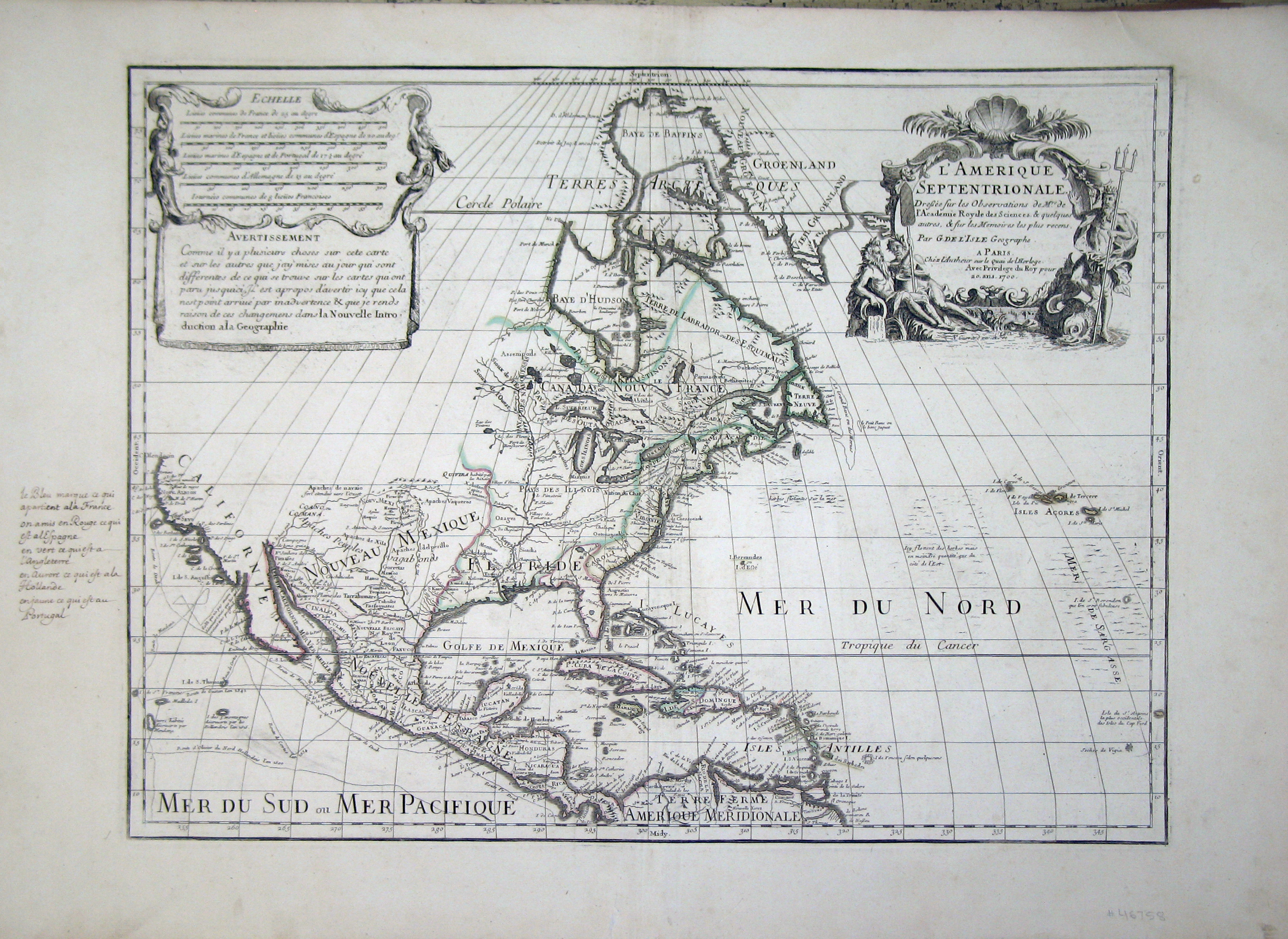
Guilaume Delisle was only twenty-five years old when he constructed this map, which was soon recognized as a landmark map. With this map (shown here in a later state which corrected an earlier westward bend in South America), Delisle was one of the first cartographers since 1625 to correctly show California as a peninsula rather than as an island. By choice he left a big portion of northwestern North America blank since he had determined (correctly) that no reliable information was yet available for the area. Delisle, as the French king's geographe de cabinet, was focused on the scientific accuracy of this map.