Historical Era:
Place Created: Strasbourg, France
Year Created: 1507
Historical Theme:
Categories of Documents:
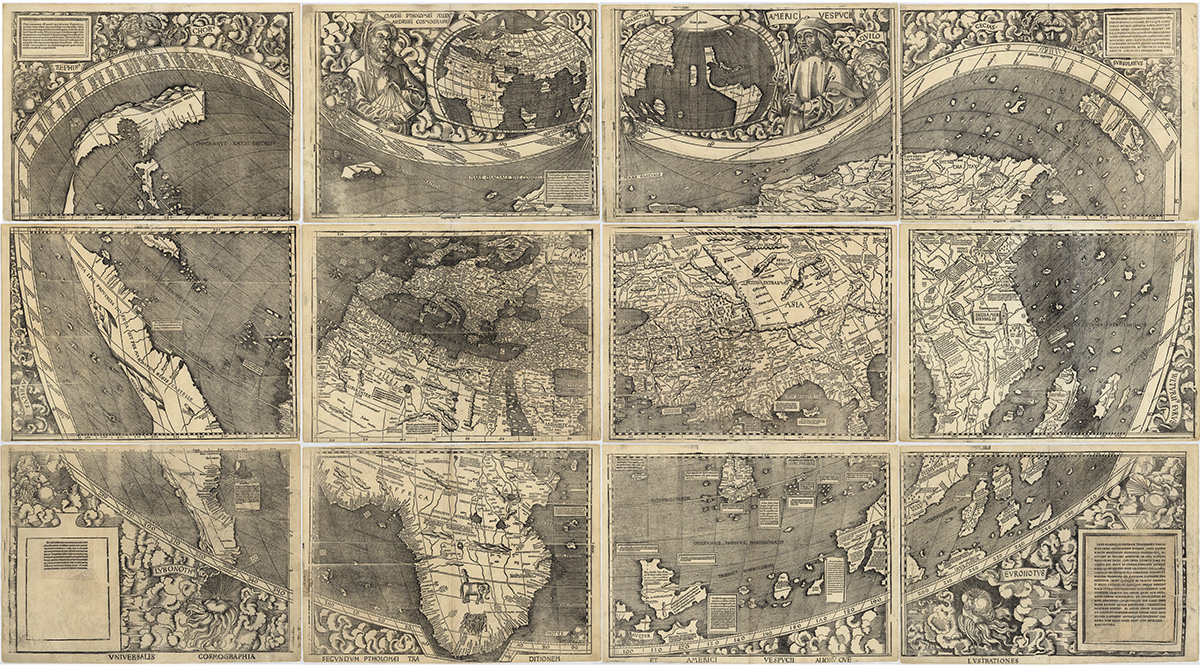
Martin Waldseemüller’s 1507 world map grew out of an ambitious project in St. Dié, near Strasbourg, France, during the first decade of the sixteenth century, to document and update new geographic knowledge derived from the discoveries of the late fifteenth and the first years of the sixteenth centuries. Waldseemüller’s large world map was the most exciting product of that research effort, and included data gathered during Amerigo Vespucci’s voyages of 1501–1502 to the New World. Waldseemüller christened the new lands "America" in recognition of Vespucci ’s understanding that a new continent had been uncovered as a result of the voyages of Columbus and other explorers in the late fifteenth century. This is the only known surviving copy of the first printed edition of the map, which, it is believed, consisted of 1,000 copies.
Waldseemüller’s map supported Vespucci’s revolutionary concept by portraying the New World as a separate continent, which until then was unknown to the Europeans. It was the first map, printed or manuscript, to depict clearly a separate Western Hemisphere, with the Pacific as a separate ocean. The map represented a huge leap forward in knowledge, recognizing the newly found American landmass and forever changing the European understanding of a world divided into only three parts—Europe, Asia, and Africa.
The 1507 world map by Martin Waldseemuller is often called "America's Birth Certificate," because it is the first document on which the name "America" appears. German Chancellor Angela Merkel officially transferred the map to the Library of Congress in April 2007. House Majority Leader Steny Hoyer accepted the map on behalf of the U.S. government, and Merkel, Hoyer and Librarian of Congress James H. Billington delivered remarks at the ceremony. The Library of Congress had purchased the map for $10 million in 2003.
One map on 12 sheets, made from original woodcut.
Source: Waldseemüller, Martin. Universalis cosmographia secundum Ptholomaei traditionem et Americi Vespucii aliorumque lustrationes. [Strasbourg, France?: s.n, 1507] Map. Retrieved from the Library of Congress, <www.loc.gov/item/2003626426/>.

