Historical Era:
Place Created: Antwerp
Year Created: 1562
Historical Theme:
Categories of Documents:
Summary from Library of Congress:
The late fifteenth-century landfall by Christopher Columbus on the island of Guanahani, in the Bahamas, forced open the gates to a whole new world for the Spanish and other European explorers. America, as it came to be called, became the destination for numerous expeditions and adventures from 1492 onward. Through papal bulls in 1493 and the famous Treaty of Tordesillas between Spain and Portugal in 1494, the two Iberian powers laid claim to the entire Western Hemisphere, although to them the newly found lands were extensions of Asia, or islands off its coasts.
During the next seventy years, a veritable avalanche of individual and state-supported efforts ensued to discover, explore, and understand the fullness of America, although initially the efforts were concentrated along its extensive coastlines. Exploratory forays continued well into the eighteenth century until every segment of America, from Canada to Tierra del Fuego, was visited and studied.
In sixteenth-century Europe, authoritative knowledge of the geography of America was based upon the observations of primarily Spanish- and Portuguese-sponsored explorers and navigators, as interpreted and plotted by official cosmographers and cartographers of the crowns of Spain's new overseas empire. As Europe's vision of trade and land acquisition shifted from the Mediterranean Sea to the Atlantic Ocean, the information that this institution acquired about its new territories was vital to Spain's world power status. Comprehensive changes in long-held geographical concepts were produced as practical observation countered time-honored ideas about the shape of the world and the areas that comprised it.
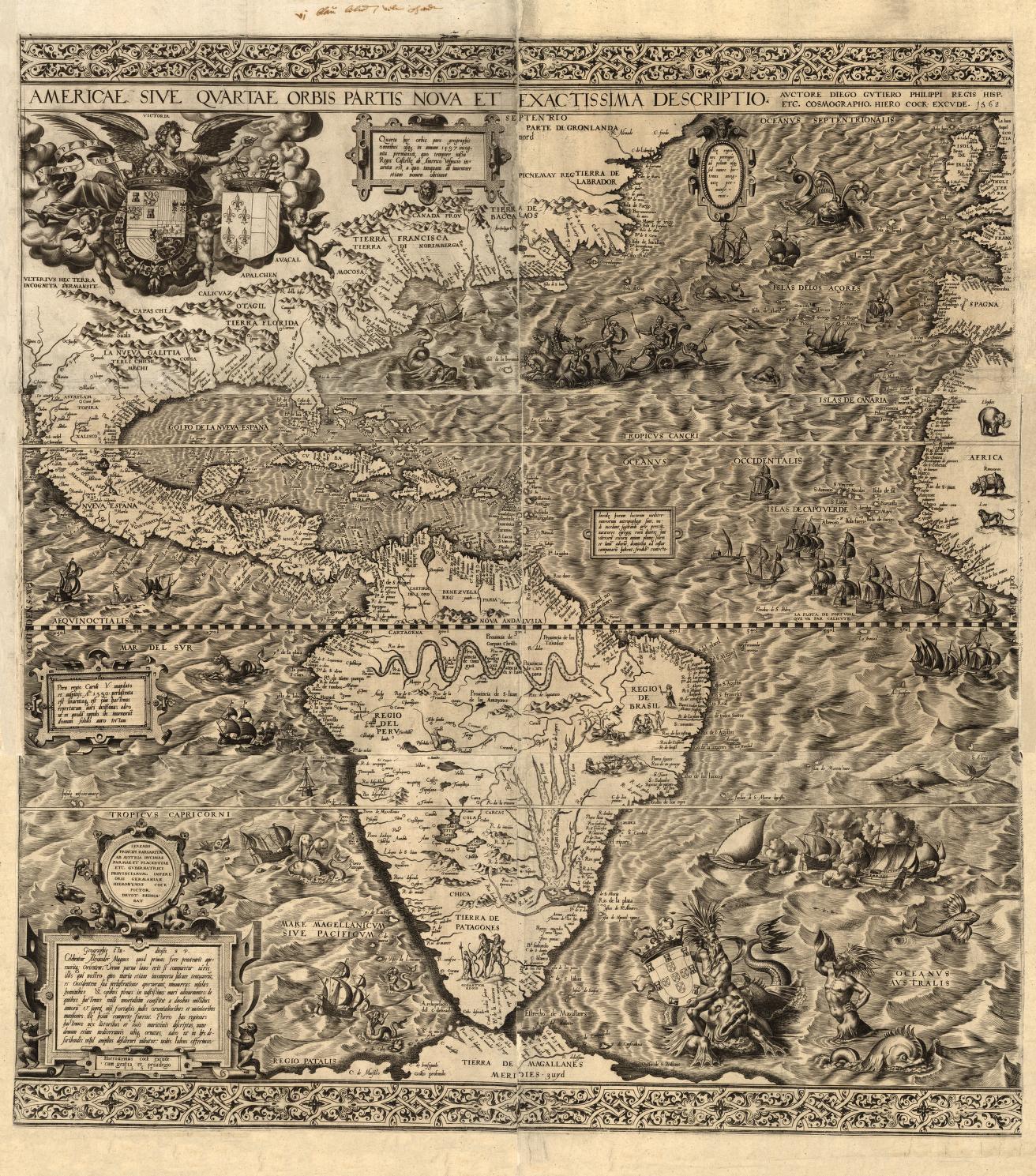
In 1562 Diego Gutiérrez, a Spanish cartographer from the respected Casa de la Contratación, and Hieronymus Cock, a noted engraver from Antwerp, collaborated in the preparation of a spectacular and ornate map of what was then referred to as the fourth part of the world, America. It was the largest engraved map of America to that time.
1 map ; 83 x 86 cm., on sheet 100 x 102 cm.
Source: Hébert, Dr. John R. “The 1562 Map of America: Articles and Essays: Discovery and Exploration: Digital Collections: Library of Congress.” The Library of Congress, www.loc.gov/collections/discovery-and-exploration/articles-and-essays/the-1562-map-of-america/. Accessed 25 Mar. 2025.
Gutiérrez, Diego, Active, Hieronymus Cock, and Lessing J. Rosenwald Collection. Americae Sive Qvartae Orbis Partis Nova Et Exactissima Descriptio. [Antwerp: s.n, 1562] Map. Retrieved from the Library of Congress, <www.loc.gov/item/map49000970/>.

