Historical Era:
Year Created: 1864
Publisher: Bacon & Co.
Historical Theme:
Collection:
Categories of Documents:
Description:
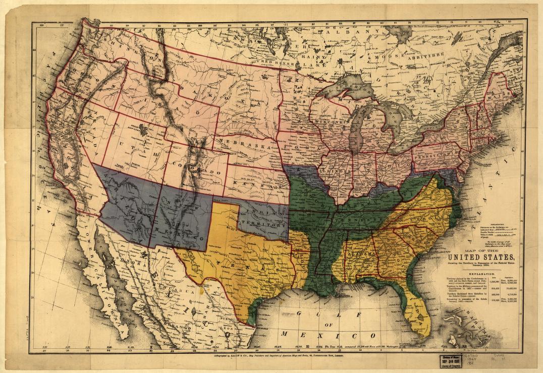
This map from January 1864 indicates by color the territories “claimed by the confederates in 1861,” “in the military possession of the Confederates in 1861,” “reclaimed from rebellion by the Federal Union,” and “remaining in possession of the Rebels January, 1864.” Map also includes rail lines and gauges, towns, forts, rivers, state boundaries, and distances by rail.
Source: Bacon & Co. Map of the United States, showing the territory in possession of the Federal Union, January. [London Lithographed by Bacon & Co, 1864] Map. Retrieved from the Library of Congress, <www.loc.gov/item/99447141/>.
Link to content: